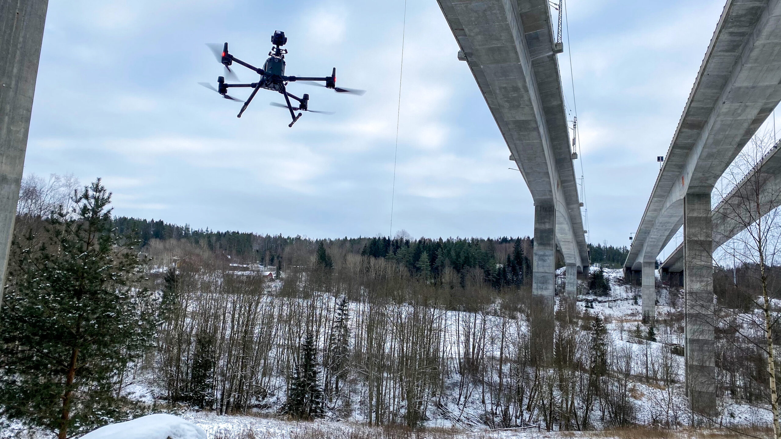
Together with our partners in Bane NOR, we have carried out tests to see if bridge inspections can be carried out more efficiently, and reduce costs by utilizing drones!
The test ahead
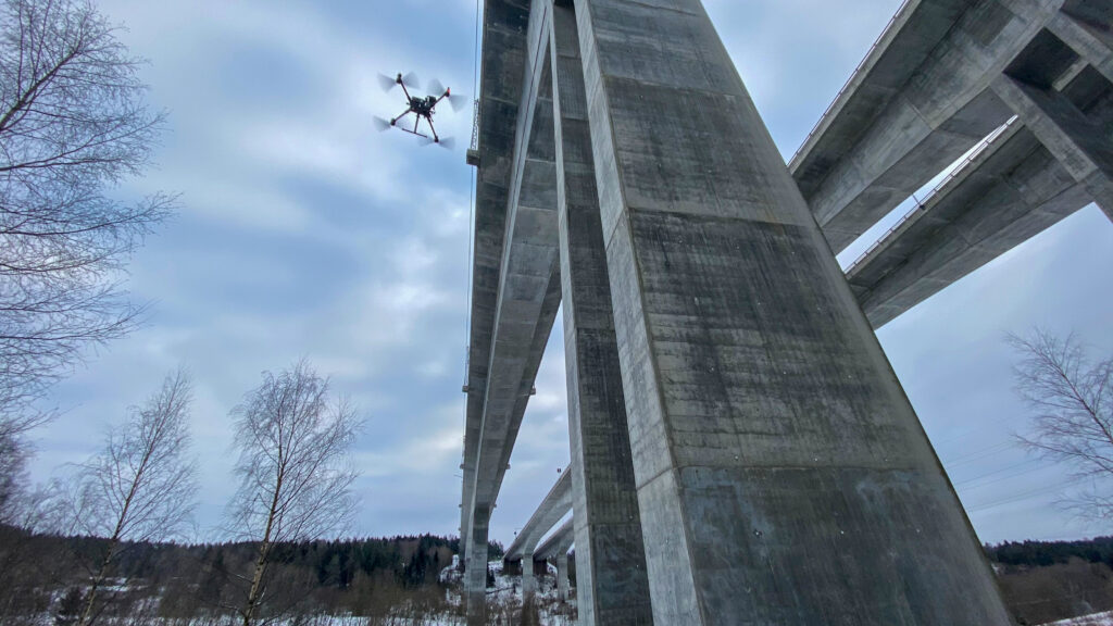
The work ahead was to inspect the Hølen bridge structure for inspection purposes using optical imagery. LiDAR data and thermal imagery were also part of the test project to check the capabilities of these types of data. A specific part of the bridge was focussed on using these two data types and technology.
The extended scope of work was to perform the data acquisition under specific weather conditions (winter conditions) as part of a comprehensive feasibility study.
The bridge is in Hølen, Vestby Kommune (Viken Fylkes), in the eastern part of Norway, approximately 45 km south from Oslo. The bridge is approximately 416 meter long.

Challenging winter conditions
The weather conditions were challenging, ranging from snow, rain and fog, and with temperature levels reaching as much as -18 degrees celsius. Conducting inspections in the winter months means less access to natural light, with only 3 to 4 hours of good conditions. Some vegetation in and around the bridges was also obstructing some of the view.
The inspection was livestreamed to bridge experts in Bane NOR, making it possible for the pilot and the viewer to communicate in real-time.
Bridge engineer in Bane NOR, Ian Willoughby, explains the benefits of bridge inspection through drones in an article published on BaneNOR webpage :
“Bridge inspection via Teams worked surprisingly well. We tested a new thermal camera, and now in these covid-19 times it was very convenient to be able to use new technology and remote viewing for this! In Teams, we gathered bridge engineers and colleagues who work with new technology. Here we discussed the data almost in real-time and gave the drone pilot instructions on where we wanted the drone to fly.”
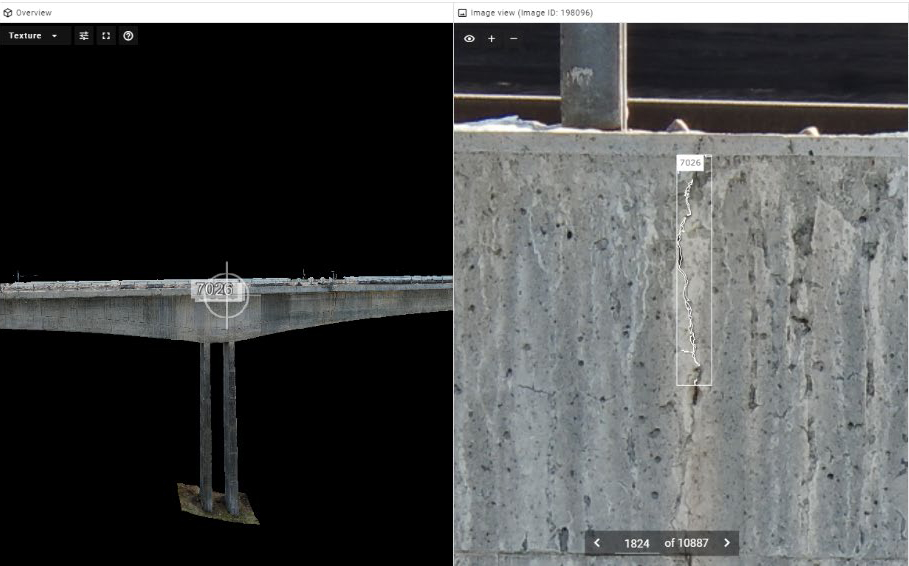
The images are processed using an AI algorithm to automatically detect any fault on the bridge structure and surface.
Automatic detection of faults
Data processing was performed using the dedicated photogrammetry and analysis software.
The software combines photogrammetry procedures to generate a 3D model and provides geolocation/positioning context to the data that will be inspected. Once the 3D model is generated, it is texturized with high detailed images of the bridge/structure.
At the same time, these images are processed using an AI algorithm to automatically detect any fault on the bridge structure and surface. Faults are automatically classified in cracks, rust, corrosion, exposed reinforcement, etc.
The seamless software
Users can easily review the faults detected and take actions if required, and automatically report faults according to inspection standards.
Have a look at the demonstration of the software!